How Mars Maps Fueled Planetary Fascination: From Cartography to Colonization
For centuries, Mars has captivated humanity's imagination. From ancient astronomers observing a "red star" to modern scientists meticulously planning robotic missions, our fascination with the Red Planet is undeniable. A crucial element in this enduring intrigue? The evolution of Mars maps. These aren't just static representations; they're dynamic tools that have fueled scientific discovery, ignited public interest, and shaped our ambitions for future Martian exploration and even colonization.
The Early Days: Speculation and the First Sketches
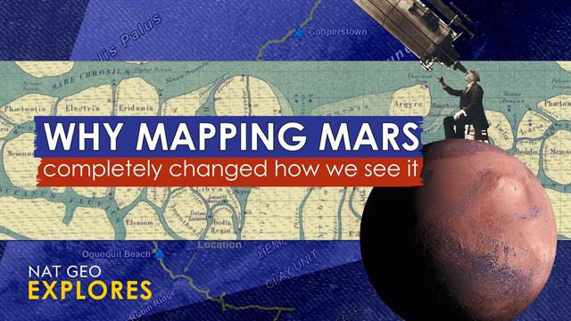
Early maps of Mars, predating sophisticated telescopes and spacecraft, were largely speculative. Based on limited observations, astronomers envisioned canals, oceans, and even Martian civilizations. These early depictions, while inaccurate, played a vital role in igniting the public's imagination and fostering a sense of wonder about what might lie beyond Earth. The "canals" of Mars, famously observed (and later debunked) by Percival Lowell, became a powerful symbol of this early era of Martian cartography and its influence on popular culture.
Key Figures and Their Contributions:
- Giovanni Schiaparelli: His detailed observations and maps, though containing errors, sparked intense debate and further investigation.
- Percival Lowell: His influential, albeit flawed, interpretations of Martian surface features fuelled the "canals" myth and captivated the public's imagination.
The Space Age Revolution: Data-Driven Cartography
The launch of the Space Age marked a turning point. With robotic missions like Mariner 4, Mariner 9, and the Viking orbiters, we transitioned from speculative maps to data-driven cartography. These missions provided the first close-up images of Mars's surface, revealing a landscape far more complex and fascinating than previously imagined.
High-Resolution Imaging and 3D Mapping:
- The Viking missions: Provided the first global views of Mars, revealing vast canyons, volcanoes, and polar ice caps.
- Mars Global Surveyor (MGS): This mission produced high-resolution images, drastically improving the accuracy of Martian maps and revealing geological details previously unseen.
- Mars Reconnaissance Orbiter (MRO): MRO continues to provide stunning high-resolution images and detailed topographic data, allowing scientists to create incredibly precise 3D maps of Mars.
From Static Images to Interactive Exploration:
Modern Mars maps are far more than simple representations; they are interactive tools used for scientific analysis, planning robotic missions, and even simulating human exploration. Websites like the USGS Astrogeology Science Center provide public access to these incredible datasets, allowing anyone to explore the Red Planet virtually.
Interactive Maps and Virtual Exploration:
- Google Mars: Offers a user-friendly interface allowing exploration of high-resolution images and topographic data.
- NASA's Planetary Data System (PDS): A comprehensive archive of planetary data, including extensive datasets on Mars.
The Future of Martian Cartography: Preparing for Human Missions
As we move closer to sending humans to Mars, the role of cartography will become even more critical. High-precision maps will be essential for selecting landing sites, planning mission routes, and understanding the Martian environment. These maps will not only guide robotic missions but also inform the design and implementation of human habitats and infrastructure.
Key Applications for Future Human Missions:
- Resource identification: Mapping water ice deposits, minerals, and other resources vital for human survival.
- Hazard assessment: Identifying potential dangers such as steep slopes, unstable terrain, and radiation hotspots.
- Habitat site selection: Choosing safe and suitable locations for establishing permanent human settlements.
Conclusion: A Legacy of Discovery and Inspiration
Mars maps have played a pivotal role in shaping our understanding and fascination with the Red Planet. From early, speculative drawings to today's incredibly detailed interactive models, they represent a journey of scientific discovery and technological advancement. As we stand on the cusp of human exploration of Mars, these maps will continue to be indispensable tools, guiding us towards a future where humanity expands its presence beyond Earth. The next chapter in the story of Martian cartography promises to be even more exciting and impactful than the last. Stay tuned for more updates on the latest Martian discoveries and mapping advancements.
